When thinking of space technology, what pops into many Chinese people’s minds are the Long March carrier rocket, Chang’e lunar probe, Shenzhou spacecraft or Fengyun meteorological satellite, all of which are very far removed from everyday life. However on closer examination, the technologies behind these aerospace machines are now being used in people’s day-to-day activities, bringing greater convenience and efficiency as they are to become part of humanity’s future.
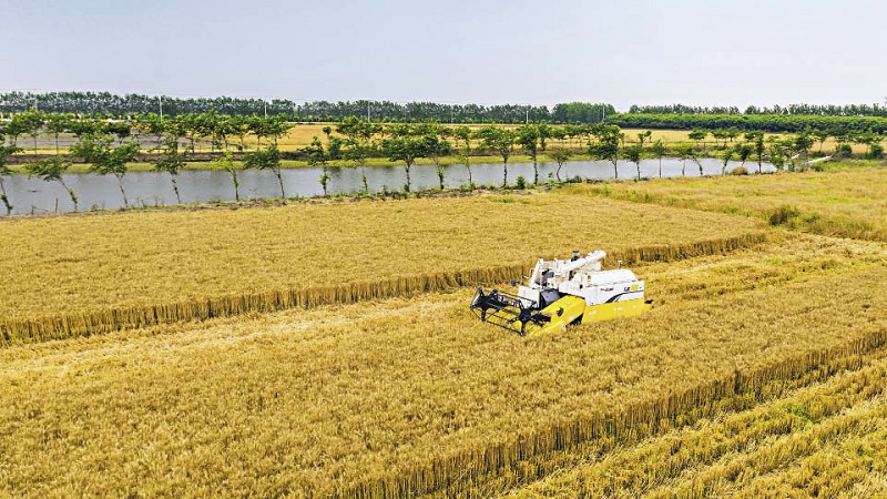
An unmanned wheat harvester connected to the BeiDou Navigation Satellite System is operating on a farm in Hai’an City, Jiangsu Province on May 28, 2020.
Saving Time in Travel
During the Labor Day holiday, Liu Qiang, a resident of Beijing, and his family drove to the countryside to do some hiking. Before starting the car, he turned on its navigation system and typed in his destination. In a second, the optimal route appeared on the screen, allowing him to avoid the congested traffic sections. This navigation service is supported by the BeiDou satellite system, or BDS, which is independently developed and deployed by China. BDS now provides accurate positioning, navigation, and timing (PNT) services under all weather conditions to people worldwide. Starting in 1994 with BDS-1 and up to 2020 with BDS-3, the system was completed after the launching of 59 satellites, including 55 navigation satellites and four navigation test satellites.
“When connected to the BeiDou navigation system, my car will sound an alarm when I deviate from the set route, overspeed, and overload. This makes driving smarter and safer,” Liu told China Today. The BDS services are critical to the development of smart vehicles, as accurate positioning is the basis for context recognition of such vehicles and data collection for high-precision maps.
As the sun’s rays became stronger, Liu put on the smart glasses he recently bought, which can automatically change lens color according to the intensity of sunlight. Such smartness comes from another aspect of space technology — gallium arsenide solar cells, which are also originally used in satellites. These cells turn light into electricity, and thereby power the chip in the sunglasses to induce color-changing of the light-sensitive liquid crystal lens.
On reaching their destination, Liu and his family headed into the mountains, where they enjoyed great fun together. On the way back, they got lost, but easily found the exit with help from the navigation app in their smartphone. More than 70 percent of smart phones in China are connected to BDS.
Protecting Crops
Zhao Wenfu, a farmer in his 50s from Houzhen Town, Shouguang City, Shandong Province, has always been keenly aware of the weather’s impact on farming. “During my childhood, a spring frost one year killed almost half of the wheat crops my parents had planted. With the poor harvest that year, we didn’t have enough to eat,” said Zhao. He thought to himself at the time, “If we can forecast the weather and take preventative measures in advance, much of our loss could be prevented.” His childhood wish is a reality today.
In September 1988, China successfully launched its first meteorological satellite FY-1. During the following years, the country carried out more meteorological disaster research based on satellite remote sensing and data analysis, and has consequently improved its capacity for predicting and responding to severe weather events like typhoons, storms, floods, cold snaps, heavy fog, frost, ice floods, drought, and sand storms. Zhao’s daily routine now includes checking the weather broadcast every night, which enables him to better protect his crops.
Meteorological satellites can actually deliver more benefits than just weather forecasting. For example, they allow agricultural technicians to monitor the growth of crops, detect pests at an early stage, take prompt control measures, and thereby increase output. They facilitate crop rotation and eco-friendly intensive agriculture, hence increasing farming efficiency. They also provide accurate measurement of plantation areas of different crops, information of their distribution and quantitative analysis of relevant data, therefore making targeted management possible. And in addition, they profile soil conditions of different regions, helping farmers to apply fertilizer accordingly and consequently increase yield.
In June 2018, China sent Gaofen-6 into planned orbit, its first high-resolution agriculture observation satellite. Compared with other areas, remote sensing in agriculture is more complicated and demanding. The reasons are many. For example, the growth cycle of a crop is usually a few months, of which only one or two months are eligible for remote sensing; this demands high timeliness of monitoring. In addition, there are a great variety of crops planted across China; and this means a wide range of elements need to be monitored. With the merits of high resolution, wide swath imaging, a shorter revisit time, and quantitative detection, Gaofen-6 provides invaluable help to agriculture production.
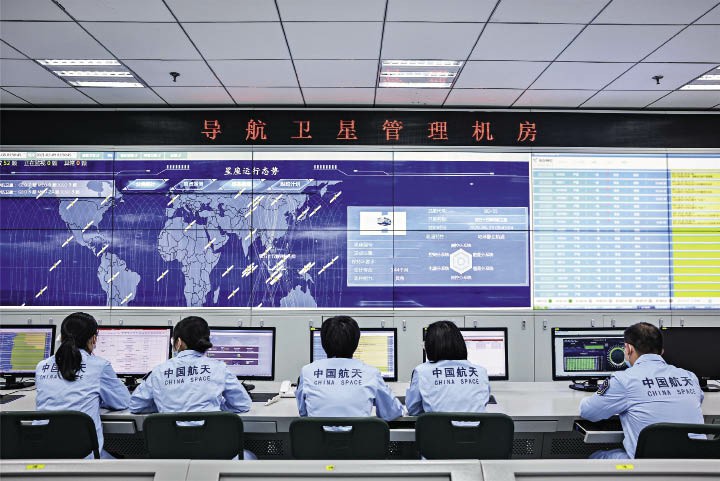
Scientists at Xi’an Satellite Control Center examine the functioning state of the 52 BeiDou satellites in orbit on February 9, 2021. The aim is to ensure that the system can provide good services during the Chinese New Year holiday in 2021.
Helping Firefighters
Fire and rescue service is dangerous, and sometimes costs lives. The development and application of space technology has provided extra protection for people working in this field.
Last March, a wildfire ravaged the suburbs of Xichang City, Liangshan Yi Autonomous Prefecture, Sichuan Province. When firefighters raced to the scene, they each carried a device with Beidou positioning and telecommunication functions. It kept them better informed of the fire condition and better protected from it, making their operation safer, better organized, and more efficient.
Another function of space technology used on this firefighting mission was smart grasp technology. It is based on a constellation of geostationary and polar orbiting satellites, and employs an AI+ fire detection algorithm for remote sensing images using big data. Thanks to this technology, firefighters can conduct all-day-long, full-dimensional monitoring of the fire scene, promptly detect flames and respond rapidly. With the advancement in such technologies as remote sensing, geographic information, and big data, satellite remote sensing has been widely used in preventing and combating forest fires in China.
A fire extinguishing bomb developed by China Aerospace Science and Industry Corporation Limited is one more example of space technology used in firefighting. It can be propelled as far as 800 to 1,200 meters from the launcher, and put out a blaze of more than 50 square meters in a single shot, significantly reducing the risk faced by personnel working on the scene.
From the first satellite it launched in 1970 to the return of the Chang’e-5 probe carrying lunar samples to earth, China has made big strides in space technology over the past decades. In the coming years, space technology will be put into broader use in people’s lives to bring more comfort, convenience, and safety.


